Saturday, 16 August 2014

Fraser Island - Whale Time

Gary Davie and Jonathan Rihan joined me for a week of paddling on Fraser Island in Whale season with no set agenda or plan other than to paddle up to Sandy Cape on the biggest spring tides of the year and to enjoy the remote north end of this beautiful island, away from the tourist boats whose diesel engine drone would be enough to drive me up to the Whitsundays if I was a Humpback Whale on my yearly migration to the warmer climes.

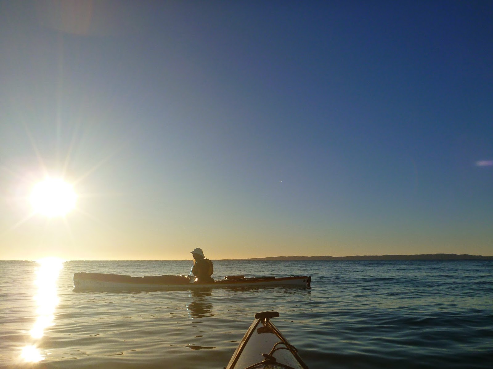
The trip coincided with the August 2014 full moon which was the closest the moon passed to the earth this year which gave us the opportunity to enjoy some wonderful sunsets and sunrises with only whales, dolphins and the occasional dingo for company.


Fraser Island is a sand island with amazing amounts of fresh water available if you know where to look.  With this in mind we chose to bring along minimal water, with Gary bringing a water filter which allowed us to restock our water supplies whenever we wanted.  This filter did a brilliant job of turning brackish water into clean drinking water.

  We took less meals than we needed on the basis that we would catch some fish along the way and we could make do in the event that our fishing exploits were unsuccessful.  Armed with some frozen worms and some backup dehydrated worms we were lucky enough to catch a couple of meals, though we had to work for it given the amount of commercial fishermen who were netting all the way along the coast up to Sandy Cape!  Yup, was a bit angry about the exploitation that is happening in this beautiful part of the world - not sure if some of the commercial fishing was happening in areas that they weren't supposed to be in as it just wasn't policed adequately - and how is inshore netting sustainable?


We ended up staying at each campsite for two nights which allowed us to relax without the pressure of having to move campsites every day.  To do this we paddled some longer days with 38 kms being the shortest paddle and 50 kms ending up the longest (not to mention the 20 knot headwinds we slogged into on that day!).  We spent the rest days fishing, beach combing and just chillin' whilst watching the Whales and Dolphins pass by.


 Day 1 saw us paddle from Urangan Harbour to Awinya Creek.  There was little whale activity in the lower part of the bay, and most whales sighted would have been swamped with Tourist boats.  The bulk of our Whale sightings were from Awinya Creek northwards with the best interactions being around Rooney Point.

Our first campsite was about 800 meters up from the creek mouth (close to where the 4WD's cross the creek).  We had some sand flies to deal with but apart from that we had fresh water (at low tide) on one side and the beach on the other.

Day 2 was a rest day and cook up day to try and lighten our boats for the paddle up to Sandy Cape.


Day 3 was a 42 km paddle from Awinya Creek, with a directish line to Rooney Point and up to Sandy Cape.  We had a couple of whale encounters on the way to Rooney so our track may have had some diversions in it. We had a mother and calf very interested in us as we headed towards Rooney - the photo's below show them coming up under my kayak for a closer inspection.

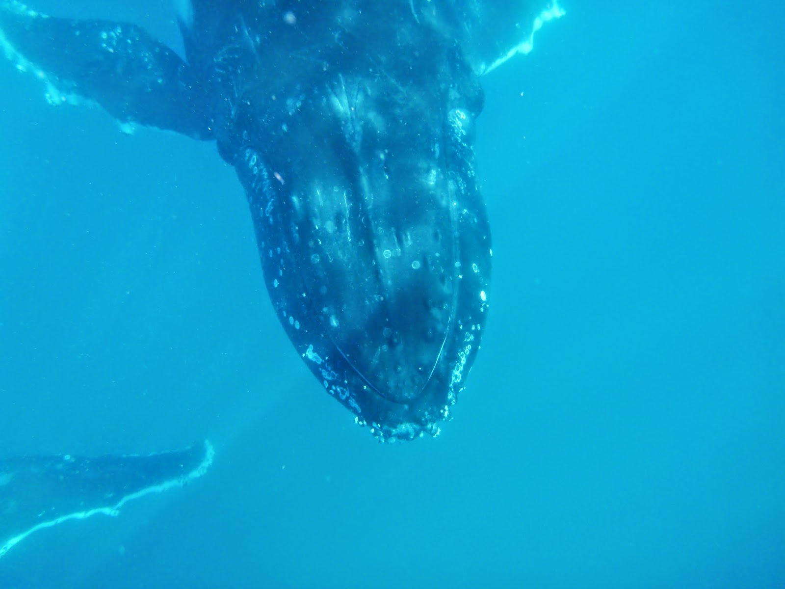


The mother took a liking to the Grey Taran.  Initially, she came out of the water vertically about a meter away from the kayak to have a closer inspection.  We moved away a little and then she came up under the kayak again and lifted her fluke less than a meter away from Gary who didn't really hang around to appreciate the close encounter.  I always feel privileged to paddle with these gentle inquisitive giants who seem to be very aware of their size and have never actually touched our kayaks, though have moved within a meter of us.


After this amazing encounter, we paddled around Rooney Point up to Sandy Cape where we were greeted by a couple of large Manta Rays, some sharks and more Dolphins.

Day 4 was a day paddle up to Flinders Sand blow and a visit to the Sandy Cape Lighthouse where we topped up our water supply and got some patchy Telstra 3G reception from the table in front of the lighthouse. The Dolphins kept us entertained chasing fish into the shallows and feeding on them as the whales passed slowly by.  There were a number of bait fish schools which made themselves scarce as the commercial fishermen came through with their nets.


Day 5 had us paddling into a 20+ knot headwind at times on our 50 km paddle back from Sandy Cape to Awinya Creek via the scenic coastal route.  At times, our progress was down under 3 kms/hr with the gusts and against tide.  We had a number of Whale encounters along the way, including a couple which we assume were mating in the waters near Wathamba Creek.  We had been watching a whale coming out of the water and lifting its fluke and pushing another stationary whale around and were concerned that something was wrong with the stationary whale. She was very large and it was not normal behaviour for her to be floating on the surface.  We didn't get too close as we were concerned the other whale that was pushing her around may have been distressed and didn't want to get in the way - but when we paddled over they moved off together looking a little sheepish and perturbed with our interruption.

After another downpour, the wind dropped and swung more easterly and after a short period of calm, we paddled into the evening with the incoming tide down to Awinya where we setup camp in the rain and wind in the dark.


Day 6 was a rest day to dry out our gear and clean out some food for our trip home.  We caught a feed of whiting for lunch and I did some exploring of the swamp lands along Awinya Creek.


Day 7 was the trip back from Awinya Creek to Urangan Harbour via Moon Bank.  We had decided to get back a day early as the weather was closing in and they were predicting a lot of rain and wind for the following day.  We made some good time on the way back with some contrary cross winds and some lumpy seas.  We had a short break on Moon Bank in the lee of the grassy hummock offering us some protection from the wind before we made the next hop into the Harbour and hot showers!


Last time I paddled to Sandy Cape I was in an overloaded skeg boat and was on my way to paddle the 90+km crossing to Lady Elliot Island and up through the Capricornia Cays.  I couldn't help reflecting that paddling these faster touring boats with rudders certainly would have made that trip a lot easier on the body and a lot safer.  Looking forward to the next big trip in 2015!

I have a theory that there is some symbiotic relationship between Humpback Whales and Bottle-Nose Dolphins.  I have seen these dolphins guiding the whales through their local waters both at the top of Fraser Island and at North Stradbroke Island.  I will see if I can dig up any research in this area and will share my findings.  The following link is a quick edit of some of the whale footage and images I captured whilst we were on this trip, and you may notice that Dolphins are photo bombing the whale footage on various occasions.

For those of you who have read my trip reports before, I usually do a what worked well and what turned to crap section.  So, nothing turned to crap and we had no gear failures to talk about but the things that worked really well were:

  • Gary's special yogurt recipe (overnight prep so ready for breakfast); and
  • Water purifier/filter (Platypus Filter Review). 


Sunday, 3 August 2014

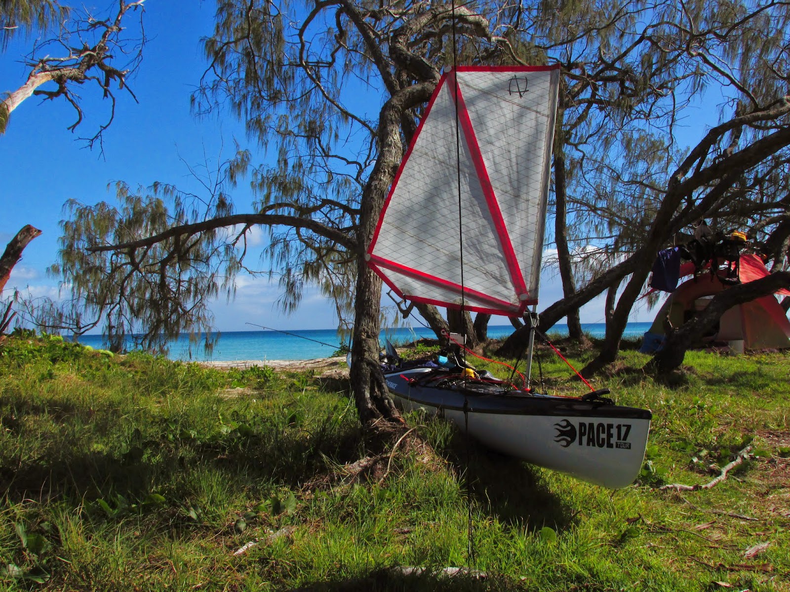
Testing the new Flat Earth Sail install in the Pace 17 Tour


Why do I like kayak sailing?  Traveling 42 kms in just over 4  hours is probably reason enough, but the fun of having your kayak running at 20 kms/hr as you catch the swell lines that just keep on forming is pretty special.  A 42 km slog turns into a 42 km surf session!

I was blown away by the new sail (yes - very droll...;-).  The only part of the setup that failed was that I lost a mini bow shackle that came undone.  There were two options in these shackles, and I chose the one that could be done up with your fingers and Jon chose the one that needed a flat bladed screw driver.  I think the water pressure hitting the shackle lug caused it to come loose so I'll be purchasing the ones that need the screw driver as replacements.

The swell picked up as we headed into the open water and we had some steep meter and a half + waves to drop into on our way past Wellington Point and out to Green Island. It was a hoot of a paddle and was great to get the boats up and humming.


Saturday, 26 July 2014

New Flat Earth Kayak Sails

My new kayak sail arrived this week so this weekend was spent installing the new sail and then heading off the next day for a test paddle.

The installation on the Pace 17 Tour went smoothly, utilising existing attachment points for most of the fittings and only needing to punch holes for the sail mount and the two jam cleats.  

I followed most of Mick's (from Flat Earth Kayak Sails) instructions, apart from the positioning of the jam cleats which I positioned low on the sides of the boat to keep the ropes out of the way of the deck.  

As Jon had purchased a sail at the same time for his Taran, we setup both boats together.  It took us a bit longer than expected, but we were both happy with the result as was proven by our test paddle today.

There wasn't a lot of wind for the test paddle so we headed off shore to pick up around 10 knots.  The sails performed well and the side stays kept the sail nice and upright even when taking wind on the beam.  Once I have taken the sail away for a week of paddling, I'll post about the setup in some more detail and go through what worked and what didn't.

The beam wind put some stretch into the new ropes so after 14 kms of sailing we headed back into shore to tighten the fittings before heading home into a head wind (30 kms all up).  I had the sail up for the last part of the trip back as you will see in the GPS track - playing with tacking upwind and seeing how close to the wind I could sail. 


Saturday, 19 July 2014

The Winter Westerlies

Winter has arrived and is making its presence felt in our part of the world.  With strong westerlies and only single digit temperatures predicted, I was looking forward to a sleep in and the morning spent faffing around the workshop installing the new Flat Earth Sails that we needed to fit for an upcoming expedition.  That plan fell through when Australia Post failed to deliver via their not so Express Post service, so a new plan was hatched on Friday night.

No alcohol was involved, but somehow we had decided to battle the westerlies in a one way paddle from Victoria Point to Oyster Point in Moreton Bay with the outgoing tide.  This is a great paddle when you have a southerly blow and you have a good meter or so of bay runners happening, not to be mistaken when you have an off shore (westerly) wind blowing...


The best part of the trip was when we ran with the waves for a few hundred meters whilst waiting for the Stradbroke ferry to pass by.  The rest of the 24 kms was a slog fest into a head/cross wind and the resultant wind waves.

I may have a tainted view of the trip as I pinched a nerve in my shoulder which is on the mend after a bike accident and struggled with it for the trip - just didn't have my zen mind set happening today!

The winter sunrise was the highlight of my day...that and the anti-inflammatory drugs after I got home :-)


Friday, 11 July 2014

Day paddling to Moreton Island

After a week in the mountains, it was time for an ocean paddle.  With the winds predicted to be off shore in the morning, dropping off and swinging on shore later in the day it was a perfect forecast for a day paddle over to Moreton Island return.


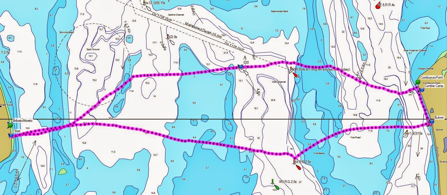
The tides lined up for us nicely with a morning high tide and and an afternoon low tide.  I always try to cross the spitfire channel within an hour of the change over of the tide as the tide can move up to 4 knots with a spring tide.


This is a technical crossing and we tend to be a bit complacent having done this on numerous occasions.  Careful planning of tides and the detailed wind models for the area are advisable.  Considerations when planning the crossing are:

  • Taking off south of Woorim on Bribie Island to Comboyuro Point is 16 kms.  We averaged 8.8km/hr on the crossing including breaks and did the crossing in 1hr 53min.  If your average speed is slower, you will need to leave a wider time margin around the tide change over.
  • Cross the Spitfire Channel at the either the M2 or M4 channel markers as you have the channel clearly defined at that point.  If you see a ship within the distance of the next marker, wait for it to pass as it will take less time than you think.  We usually cross at the M2 beacon on the way over and the M4 beacon on the way back.
  • Crossing Yule banks on the Moreton side of Spitfire Channel is perfect with crystal clear water running over shallow banks - when the waves are breaking it is a hoot, unless you don't like waves.  Beware of large easterly or north easterly swell as this will hit the banks and can even break at high tide, the explosions of white water can be seen from shore.
  • Alter your ferry glide angle depending on the tide and where you are on the crossing.  There are three points on the crossing where the tides can run in excess of 3 knots (Close to both islands and Spitfire channel).
  • Try to avoid paddling against the tide close to the islands - it can be done but you will expend a lot of effort to make slow progress.
  • Bring some cash for a hot breakfast at the shop at Bulwer.
The views from Moreton Island are always spectacular.


The problem with paddling to such a beautiful destination is the lack of motivation to paddle back in the afternoon.

Thursday, 10 July 2014

"The Head" - Condamine River

We took a short family holiday at the head waters of the Condamine River, up from Killarney in the border ranges.  We stayed at a old farm house known as "Mill Cottage" (part of Oakleigh) next to "The Head" on the slopes of Mount Superbus and the Cambanoora Gorge.

With no set agenda other than sitting in front of the fire and reading, we achieved our holiday goals.  I did take my mountain bike and rode to Killarney on the Condamine River Road which was a beautiful ride, crossing the Condamine River 14 times;  now known to me as the shoe on, shoe off ride.  In the middle of winter with sub-zero mornings, walking the creek crossings brought tears to my eyes to go with my numb feet!  It would be a good day ride to take off from Queen Mary Falls, and do the circuit via Spring Creek Rd and then Condamine River Rd into Killarney and then back up to Queen Mary Falls.